
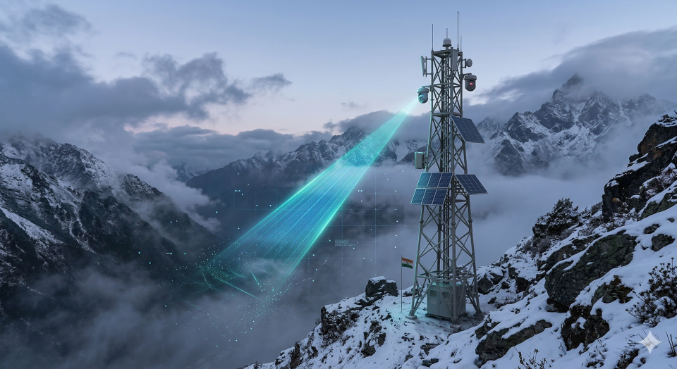
- Overview: Radically upgrading its border management grid, the Indian Army has activated a continuous chain of autonomous, AI-powered surveillance towers along the highly contested Line of Actual Control (LAC) in Arunachal Pradesh.
- Key Points:
- Unblinking Eyes: Powered by solar arrays and robust solid-state batteries, these towers are equipped with high-definition optical and thermal cameras capable of penetrating deep fog and total darkness.
- Algorithmic Threat Detection: The raw camera feeds are processed by artificial intelligence algorithms that can automatically distinguish between a wandering animal, a civilian, and an armed hostile patrol, instantly alerting command centers.
- Eliminating Human Fatigue: Guarding the treacherous, high-altitude Himalayan borders induces severe human fatigue. This automated network ensures 24/7, flawless monitoring without putting soldiers at risk in sub-zero blizzards.
- Data Integration: The towers feed directly into the Army’s broader network-centric warfare grid, allowing for rapid deployment of drone swarms or rapid reaction forces the second a border intrusion is verified.
- Q2. The boundary line that separates the Indian state of Arunachal Pradesh from the Tibet Autonomous Region of China is historically known as the:
- Radcliffe Line
- Durand Line
- McMahon Line
- Maginot Line